Thoresby Estate walks. The "permitted walk" part 2.
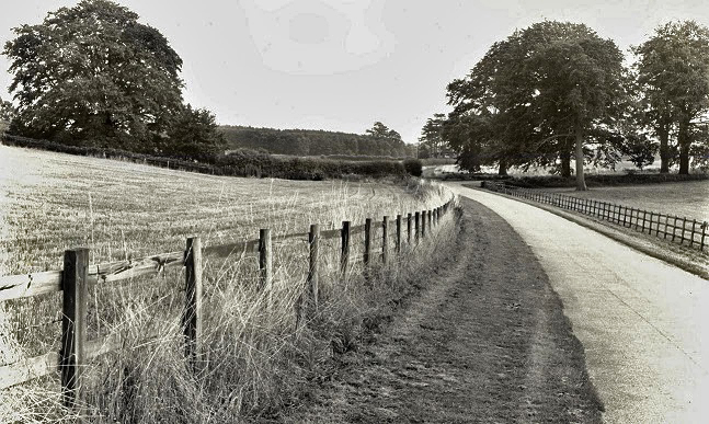
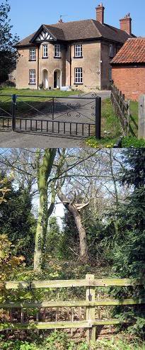
This second video of Thoresby Estate Permitted Walk (late September 2013) takes the viewer through Perlethorpe Village and over the River Meden.
For Part 1 of these Thoresby Walks videos see THIS LINK. For historical information about Perlethorpe see THIS LINK.

UPDATE 2015: Please be aware these videos showing Thoresby Estate's Permitted Walks were made in 2013. Most areas are still accessible. However, that part of the route alongside the River Meden is currently (2015) off limits due to subsidence. Also the route down to Thoresby Lake has sadly been fenced off for (so I'm told) privacy reasons.
UPDATE 2017: Please now be aware that both Perlethorpe Bridge and the road outside Perlethorpe Village Hall are now controlled by metal security gates. These may well be locked on certain days, such as Sunday, and wheel chair access may not be possible.
Labels: Manvers, Perlethorpe Village, Pierrepont, the Dukeries, Thoresby Estate, Thoresby Hall, Thoresby Park
posted by robin hood at <
$BlogItemDateTime$>
<
$BlogItemCommentCount$> comments
![]()
![]()


 Thoresby Hall Hotel, Sherwood Forest and Clumber Park are recommended attractions for a day trip or short vacation. The
Dukeries area is of keen historic interest. NOTE: Apart from public domain postcards and brochures ALL photographs herein are copyright Ian Gordon Craig, exclusive permission granted to Thoresby Estate for their use elsewhere.
Thoresby Hall Hotel, Sherwood Forest and Clumber Park are recommended attractions for a day trip or short vacation. The
Dukeries area is of keen historic interest. NOTE: Apart from public domain postcards and brochures ALL photographs herein are copyright Ian Gordon Craig, exclusive permission granted to Thoresby Estate for their use elsewhere.
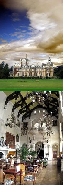 Thoresby Hall as photographed Summer 2009, now a successful Warners Hotel.
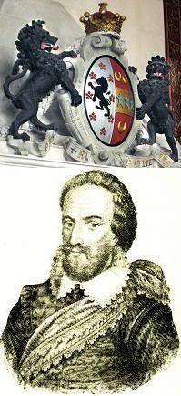 Robert Pierrepont (1584 - 1643), 1st Earl of Kingston upon Hull, bought Thoresby for his second son William.
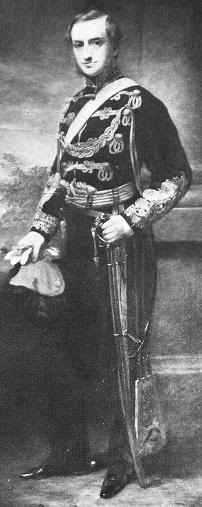 Sydney William Herbert Pierrepont (1825 - 1900), 3rd Earl Manvers, built the present Thoresby Hall, St John's Church,
Perlethorpe School, and generally shaped Thoresby Estate as it looks today.
Sydney William Herbert Pierrepont (1825 - 1900), 3rd Earl Manvers, built the present Thoresby Hall, St John's Church,
Perlethorpe School, and generally shaped Thoresby Estate as it looks today.
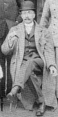 The 4th Earl Manvers (Died 1926).
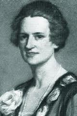 Countess Manvers (d.1984). Examples of her paintings are always on show at Thoresby Gallery.
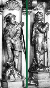
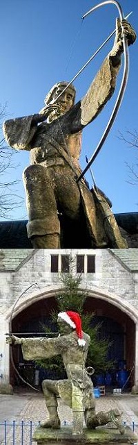 ABOVE: The statue of Robin Hood in the courtyard at Thoresby Hall, by Tussaud - Birt, is showing its age, but remains one of
my favourites. The Art Gallery, crafts shops, and restaurant within that courtyard are recommended.
ABOVE: The statue of Robin Hood in the courtyard at Thoresby Hall, by Tussaud - Birt, is showing its age, but remains one of
my favourites. The Art Gallery, crafts shops, and restaurant within that courtyard are recommended.
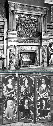 Carved oak fireplace in the Thoresby Hall library with its depiction of the Major Oak (Robin Hood's Tree), and the screen
featuring the Cromwell family. Oliver Cromwell is known to have stayed in Thoresby Hall before the English Civil War.
Carved oak fireplace in the Thoresby Hall library with its depiction of the Major Oak (Robin Hood's Tree), and the screen
featuring the Cromwell family. Oliver Cromwell is known to have stayed in Thoresby Hall before the English Civil War.
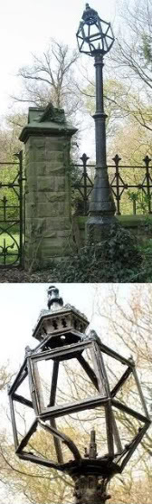
 The Green Bridge sited near the edge of the cricket pavilion in front of Thoresby Hall across which the Duke's carriage would take him to Perlethorpe Village.
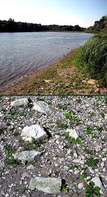 The view along Thoresby Lake towards Budby. Are these bricks at the water's edge remnants from the original Thoresby
Hall?
The view along Thoresby Lake towards Budby. Are these bricks at the water's edge remnants from the original Thoresby
Hall?
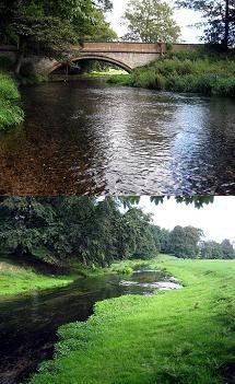 The River Meden winds its way from 7 Ton Bridge near Thoresby Hall towards Perlethorpe Village.
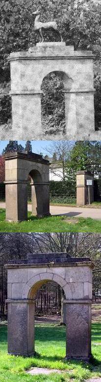
 Budby Castle, once known as William Castle, and the River Meden winding towards Thoresby Lake under the remains of
Pierrepont Bridge, once described as classical and elegant.
Budby Castle, once known as William Castle, and the River Meden winding towards Thoresby Lake under the remains of
Pierrepont Bridge, once described as classical and elegant.
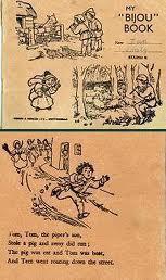 Children's exercise book from the school, 1958.

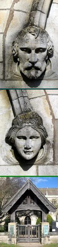
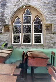
 Perlethorpe Church graveyard, where the original chapel once stood. The covered gate was a later addition in memorium to
the men of Budby and Thoresby who fell in World War 1.
Perlethorpe Church graveyard, where the original chapel once stood. The covered gate was a later addition in memorium to
the men of Budby and Thoresby who fell in World War 1.
 Robin Hood's Tree, the Major Oak, was once under the care and supervision of Thoresby Estate. Responsibility for its
upkeep changed to Nottingham City Council c.1969. Here it is pictured in in Spring, Autumn, and Winter.
Robin Hood's Tree, the Major Oak, was once under the care and supervision of Thoresby Estate. Responsibility for its
upkeep changed to Nottingham City Council c.1969. Here it is pictured in in Spring, Autumn, and Winter.